FAQ
Do I have to pay for any of this?
No, all the features here are fully legal and free to use. The various map providers all have options for free usage of their maps—some are fully free for unlimited usage, others have a monthly limit. So if this site became very popular, some of the maps might not work temporarily until the next free data limit reset some time in the following month.
Does the site work offline?
No, sorry, it's online-only. Offering a feature to store the maps tiles locally for offline use would contravene the map providers' terms of use.
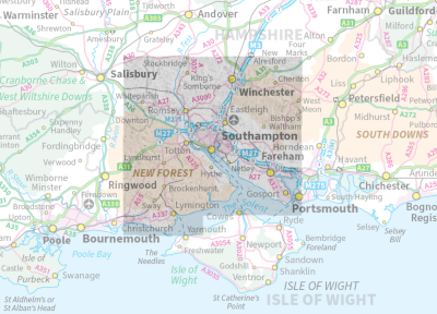
Why is the LIDAR layer here only available for south Hampshire?
So far as I know, there is no publicly-accessible store of high quality LIDAR-based DTM "hillshade" map tiles of all of Great Britain that developers can access to use on their own sites. So I had to create my own, and this is where I live.
The problem is that a site needs huge numbers of layer tiles in order to cover all the zoom levels. For example, the LIDAR "hillshade" layer on this site covers 2,025 km². That requires 501,738 map tile images taking up 7.5GB of disk space. So to cover the whole of Great Britain (over 200,000km²) would require around 750GB of virtual server storage space to hold approximately 50 million tile images. That is way more than I can afford, in both the time required to make the tiles and the cost of hosting them.
Where else can I view old GB maps or LIDAR layers?
The excellent National Library of Scotland (NLS) has a much wider selection of old maps covering all of Great Britain, and it's free to use. Plus they have a LIDAR background layer. They also allow other sites—like this one—to use a limited selection of their maps via their Historic Maps API which is hosted by the MapTiler Cloud API. It's probably due to the NLS being so excellent (it covers England too) that there's little momentum to create an English equivalent.
So why bother with this site then?
This site is more phone-friendly and is dead simple to use. And the geolocation tracking here helps to put you right on top of whichever old remains you're searching for. And (just my opinion) I believe the LIDAR map tiles here are slightly more detailed than the NLS ones. Hats off to the NLS though, it's a great resource.
The LIDAR layer isn't working
You must use the Map Opacity slider to hide (or nearly hide) the map in order to view the LIDAR layer. Also, the LIDAR layer only covers a small area on the south coast of England. To check this, you can zoom out on a map, turn on the LIDAR layer, then reduce the map opacity to see the extent of the layer.
Some of the maps aren't working
The map providers require recent web browsers in order to work. So if you have an old computer or phone then they may not work here, sorry! Also, my monthly free map limit may have been exceeded as described above.
There are no old maps for my area
Many of the old maps simply never covered some areas. Also, the original paper maps might not have been been scanned in by the NLS.
The "follow me" thing doesn't work
There are several reasons why this might happen:
- You have an old device which doesn't support geolocation services
- Your device has an old web browser or operating system
- Your device permissions are blocking geolocation requests
The compass is flaky
Yeah, most mobile device compasses are flaky. Try calibrating your compass to improve things by moving it in a figure of eight pattern a few times:
- Compass calibration for Apple devices
- Compass calibration for Android devices
What is the LIDAR layer eactly?
LIDAR (Light Detection and Ranging) is a method used to measure distance ranges using laser. In this case it was used by suitably equipped aircraft to obtain and record elevation data as part of the the National LIDAR Programme. The NLS has an explanation of how it's used for landscape research.
The LIDAR layer on this site shows map tiles based on a LIDAR Digital Terrain Model (DTM). The data was recorded at one metre intervals with an accuracy of around ± 15cms. The tiles display the underlying terrain using a "hillshade" 3D effect on the map. This helps human eyes to better visualise the underlying elevation data.
The DTM used here contains filtered data to only show the underlying ground surface. For comparison, a Digital Surface Model (DSM) would show the world as it is, including buildings, trees, etc.
Will you put up a LIDAR layer for my area of interest?
Sorry, but creating the LIDAR-based tile layer is an all-or-nothing thing because any additions would require re-creating many of the existing zoom levels to include the new layers. In other words, I can't just add little chunks here and there on an ad-hoc basis. However, the code here is free to use and copy, and I've provided detailed instructions for developers on how to make the tiles. So maybe you could persuade a local hobbyist web developer to knock up something similar for your area.
For developers: how to make the LIDAR hillshade map tiles
My workflow for making the map tiles is here: How to create LIDAR “hillshade” XYZ map tiles. You may know of alternative or more efficient ways of doing it—if so, I'm very happy to be corrected or updated. My contact details are at the bottom of this page.
I have a great idea to improve the site
I'm always very happy to talk to site users, so please feel free to email me at bobosola@gmail.com.