Demo
Here's the story that made me want to build this site (and a demo of how the site works):
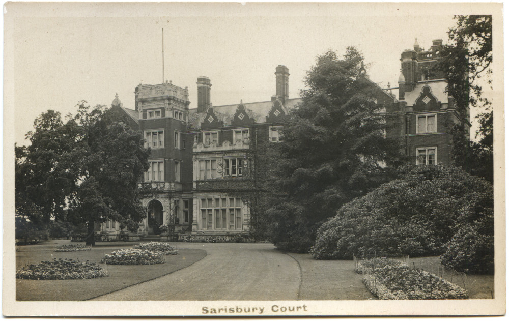
LARGEST AMERICAN HOSPITAL ABROAD
Sarisbury Court, a Handsome English Estate, Purchased by the Red Cross for Wounded Soldiers.
The largest American military hospital in Great Britain will be near Southampton, and when completed will accommodate nearly 3,000 wounded Americans from the western front. The site is a magnificent country estate of 186 acres, formerly known as Sarisbury Court.
– New York Times, Sunday August 18, 1918.
Sarisbury Court certainly was a magnificent local country mansion house. It stood on the banks of the river Hamble on the South Coast of England. Nothing of it remains standing today.
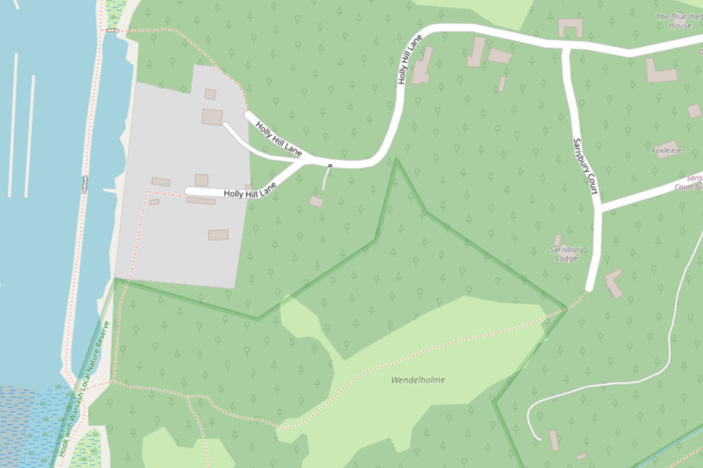
Enter "wendlehome" into the search box on the home page to be taken close to the area where it once stood. All you will see now is trees and a small modern building very close to the remains of the mansion:
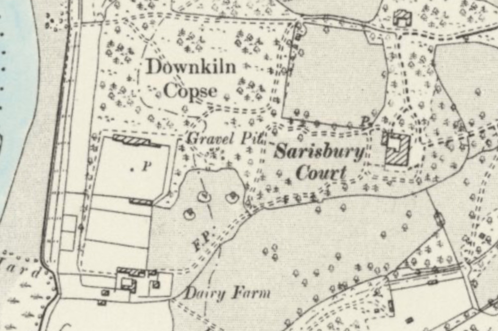
But if you change to the earliest map you will see the building in all its former glory:
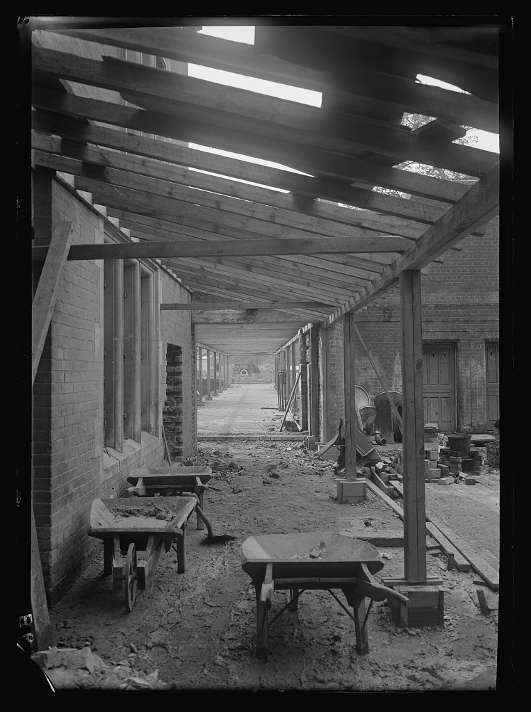
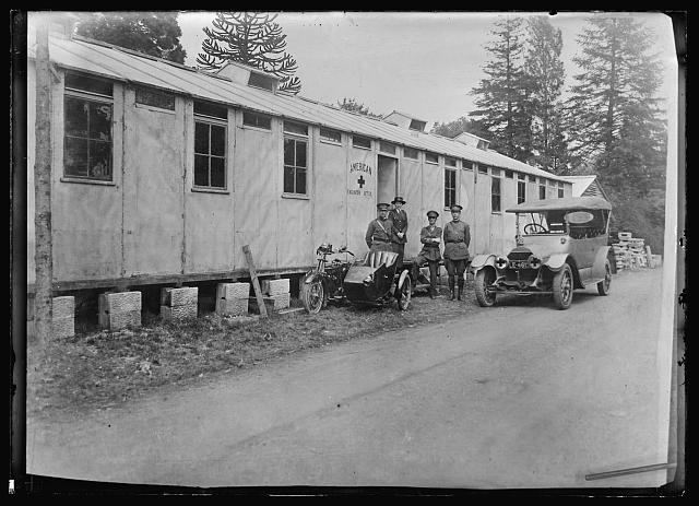
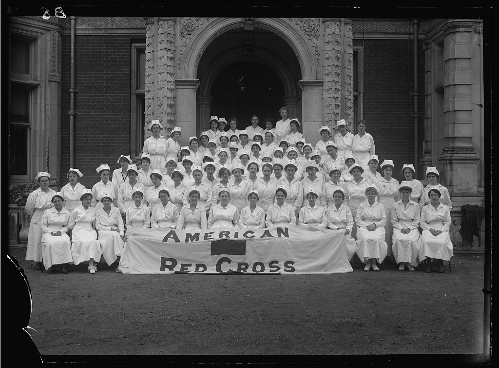
At some point towards the end of WW1, the American hospital was built in the gardens overlooking the river, but it's not clear today whether it was fully built to the original plans:
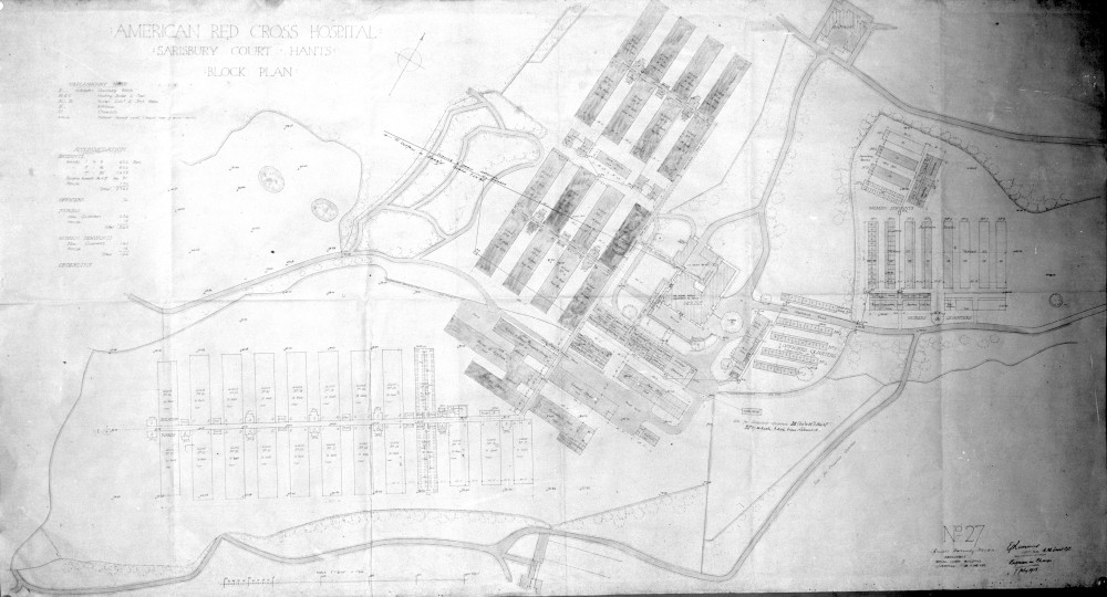
Nonetheless, it was definitely constructed and used as these photos show (there's a link to more photos at the bottom of the page):
The hospital and the mansion seem to have been demolished some time in the 1920s. The mansion had suffered more than one fire in its history and was now presumably too expensive to repair. What became of the hospital and all the staff and patients is lost to history.
Today, the location is under private ownership and is heavily wooded as you can see from the satellite images. You can see nothing of the remains of either the mansion or the hospital from the nearby road, nor is there any commemorative plaque or indeed any indication at all that either building ever existed. But the LIDAR layer lets you see the remains of both! Turn on the LIDAR layer and reduce the map opacity slider to zero. You should see something like this (click the big arrow to play the video):
The foundations of Sarisbury Court and the parallel rows of hospital buildings can now be clearly seen. I imagine someone with a metal detector could unearth all kinds of hidden treasures, given permission from the landowner of course. LIDAR data is a magical tool for uncovering our hidden lost history.
References: