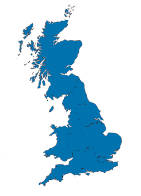
Current & Historical Maps of Great Britain

This site provides current & historical maps of Great Britain. You can see where you are now and how it looked over 100 years ago. You can have the map follow you as you move around, and look up a British place name, street or postcode. There is also a bare earth LIDAR layer for south Hampshire which can help to locate the remains of long-forgotten buildings.
Get your current GB location
Find GB places, streets, or postcode areas:
You can hit Show Filters to see some options for narrowing down the results.
These weird filter options look like they were thrown together for a bet during a drunken Christmas party. But they are all exactly as per the Ordnance Survey specifications. The spec also says that this is "a free string text search of OS Names, intended to be an ambiguous/fuzzy search". For "fuzzy" read "on acid". You can tick multiple filters—the more you tick, the more results you get. Maybe.
This is a free site written just for the fun of doing it. It has no ads, tracking, cookies, or anything else which might invade your privacy.